Business & EconomicsScience & NatureTravel
The enclosure maps of England and Wales
- Pages
- 426
- 2 editions
- First published
- 2004
- 1 language
Join or log in to shelve and rate Free, no password.
Overview
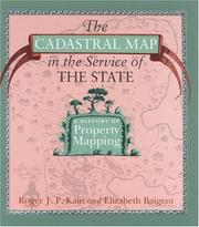
"This book offers the first comprehensive study of the enclosure mapping of England and Wales. Enclosure maps are fundamental sources of evidence in many types of historical enquiries. Although modern historians tend to view these large-scale maps essentially as sources of data on past economies and societies, this book argues that enclosure maps had a much more active role at the time they were compiled. Seen from this perspective of their contemporary society, enclosure maps are not simply antiquarian curiosities, cultural artefacts or useful sources for historians but instruments of land reorganisation and control which both reflected and consolidated the power of those who commissioned them. The book is accompanied by a fully searchable, descriptive and analytical catalogue of all the parliamentary and non-parliamentary enclosure maps extant in public archives and libraries, and offers an essential research tool for economic, social and local historians and for geographers, lawyers and planners."--BOOK JACKET.
Ratings & reviews
Log in to rate or review this book.
No written reviews yet.
Discussions
Talk about this book with other readers.
Log in to start a discussion.
No discussions yet.
Editions

Details & links
- First published
- 2004
- Pages
- 426
- Languages
- Available in 1 language
Where to buy this book: see “Buy this book”
More about this book
Read a sample, borrow it or see other editions → openlibrary.org